Canada Topographic Maps

Baie de Chaleur Topo Maps

Topography maps and Latitude/Longitude Location

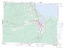
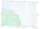
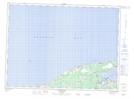
Maps showing Baie de Chaleur, New Brunswick

Baie de Chaleur is a Bay located in New Brunswick.

  • Latitude: 48° 0' North   (decimal: 48.0000000)
  • Longitude: 65° 45' West   (decimal: -65.7500000)
  • Topography Feature Category: Bay
  • Geographical Feature: Baie
  • Canadian Province/Territory: New Brunswick
  • GPS Coordinate Locator Map: Baie de Chaleur Lat/Long

Baie de Chaleur NTS Map Sheets

021P12 Bathurst Topographic Map at 1:50,000 scale

021P13 Pointe Verte Topographic Map at 1:50,000 scale

021P14 Grande-Anse Topographic Map at 1:50,000 scale

021P15 Caraquet Topographic Map at 1:50,000 scale

022A02 Port-Daniel Topographic Map at 1:50,000 scale

022B01 Escuminac Topographic Map at 1:50,000 scale

021P Bathurst Topographic Map at 1:250,000 scale

022A Gaspe Topographic Map at 1:250,000 scale

022B Matane Topographic Map at 1:250,000 scale

 
Buy Topographic Maps DVD
Newsletter Sign-up

Yes, I want to receive map store discounts.


Bookmark and Share