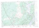
Maps showing Burton, Sunbury, New Brunswick
Burton is a Geographical area located in Sunbury, New Brunswick and has an elevation of 46 meters.
- Latitude: 45° 48' 28'' North (decimal: 45.8076678)
- Longitude: 66° 24' 6'' West (decimal: -66.4016031)
- Topography Feature Category: Geographical area
- Geographical Feature: Parish
- Canadian Province/Territory: New Brunswick
- Elevation: 46 meters
- Location: Sunbury
- Atlas of Canada Locator Map: Burton
- GPS Coordinate Locator Map: Burton Lat/Long
Burton NTS Map Sheets