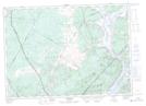
Maps showing Kingston, Kings, New Brunswick
Kingston is a Geographical area located in Kings, New Brunswick.
- Latitude: 45° 28' North (decimal: 45.4667000)
- Longitude: 66° 3' West (decimal: -66.0499999)
- Topography Feature Category: Geographical area
- Geographical Feature: Parish
- Canadian Province/Territory: New Brunswick
- Location: Kings
- Atlas of Canada Locator Map: Kingston
- GPS Coordinate Locator Map: Kingston Lat/Long
Kingston NTS Map Sheets
021G08 Saint John Topographic Map at 1:50,000 scale
021G09 Hampstead Topographic Map at 1:50,000 scale
021H05 Loch Lomond Topographic Map at 1:50,000 scale
021H12 Sussex Topographic Map at 1:50,000 scale
021G Fredericton Topographic Map at 1:250,000 scale
021H Amherst Topographic Map at 1:250,000 scale
021G09 Hampstead Topographic Map at 1:50,000 scale
021H05 Loch Lomond Topographic Map at 1:50,000 scale
021H12 Sussex Topographic Map at 1:50,000 scale
021G Fredericton Topographic Map at 1:250,000 scale
021H Amherst Topographic Map at 1:250,000 scale