Maps showing Gloucester, New Brunswick
Gloucester is a Geographical area located in New Brunswick.
- Latitude: 47° 35' North (decimal: 47.5832999)
- Longitude: 65° 25' West (decimal: -65.4166999)
- Topography Feature Category: Geographical area
- Geographical Feature: County
- Canadian Province/Territory: New Brunswick
- Atlas of Canada Locator Map: Gloucester
- GPS Coordinate Locator Map: Gloucester Lat/Long
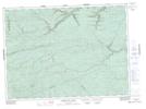
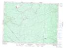
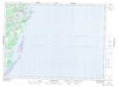
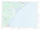
Gloucester NTS Map Sheets
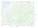
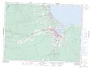
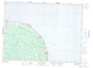
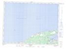
021O08 California Lake Topographic Map at 1:50,000 scale
021O09 Tetagouche Lakes Topographic Map at 1:50,000 scale
021P04 Sevogle Topographic Map at 1:50,000 scale
021P05 Nepisiguit Falls Topographic Map at 1:50,000 scale
021P06 Tabusintac River Topographic Map at 1:50,000 scale
021P07 Wishart Point Topographic Map at 1:50,000 scale
021P10 Tracadie Topographic Map at 1:50,000 scale
021P11 Burnsville Topographic Map at 1:50,000 scale
021P12 Bathurst Topographic Map at 1:50,000 scale
021P13 Pointe Verte Topographic Map at 1:50,000 scale
021P14 Grande-Anse Topographic Map at 1:50,000 scale
021P15 Caraquet Topographic Map at 1:50,000 scale
022A02 Port-Daniel Topographic Map at 1:50,000 scale
021O Campbellton Topographic Map at 1:250,000 scale
021P Bathurst Topographic Map at 1:250,000 scale
022A Gaspe Topographic Map at 1:250,000 scale