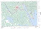
Maps showing St. Patricks Lake, Charlotte, New Brunswick
St. Patricks Lake is a Lake located in Charlotte, New Brunswick and has an elevation of 102 meters.
- Latitude: 45° 14' 23'' North (decimal: 45.2396091)
- Longitude: 67° 2' 22'' West (decimal: -67.0395612)
- Topography Feature Category: Lake
- Geographical Feature: Lake
- Canadian Province/Territory: New Brunswick
- Elevation: 102 meters
- Location: Charlotte
- Atlas of Canada Locator Map: St. Patricks Lake
- GPS Coordinate Locator Map: St. Patricks Lake Lat/Long
St. Patricks Lake NTS Map Sheets