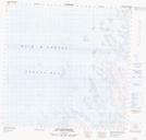
Maps showing Pointe Akuliakuluk, Rivière-Koksoak; Kativik, Quebec
Pointe Akuliakuluk is a Cape located in Rivière-Koksoak; Kativik, Quebec.
- Latitude: 59° 15' 41'' North (decimal: 59.2613889)
- Longitude: 65° 35' 39'' West (decimal: -65.5941667)
- Topography Feature Category: Cape
- Geographical Feature: Pointe
- Canadian Province/Territory: Quebec
- Location: Rivière-Koksoak; Kativik
- Atlas of Canada Locator Map: Pointe Akuliakuluk
- GPS Coordinate Locator Map: Pointe Akuliakuluk Lat/Long
Pointe Akuliakuluk NTS Map Sheets