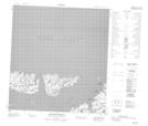
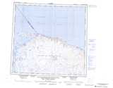
Maps showing Anse Appaluit, Baie-d'Hudson; Kativik, Quebec
Anse Appaluit is a Bay located in Baie-d'Hudson; Kativik, Quebec.
- Latitude: 62° 31' 21'' North (decimal: 62.5225575)
- Longitude: 77° 34' 57'' West (decimal: -77.5823691)
- Topography Feature Category: Bay
- Geographical Feature: Anse
- Canadian Province/Territory: Quebec
- Location: Baie-d'Hudson; Kativik
- Atlas of Canada Locator Map: Anse Appaluit
- GPS Coordinate Locator Map: Anse Appaluit Lat/Long
Anse Appaluit NTS Map Sheets