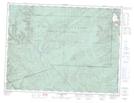
Maps showing Rivière des Béland, Mont-Albert; La Haute-Gaspésie, Quebec
Rivière des Béland is a River located in Mont-Albert; La Haute-Gaspésie, Quebec and has an elevation of 272 meters.
- Latitude: 49° 3' 25'' North (decimal: 49.0569902)
- Longitude: 65° 33' 50'' West (decimal: -65.5638148)
- Topography Feature Category: River
- Geographical Feature: Rivière
- Canadian Province/Territory: Quebec
- Elevation: 272 meters
- Location: Mont-Albert; La Haute-Gaspésie
- Atlas of Canada Locator Map: Rivière des Béland
- GPS Coordinate Locator Map: Rivière des Béland Lat/Long
Rivière des Béland NTS Map Sheets