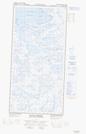
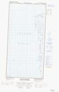
Maps showing Pointe Bernier, Baie-d'Hudson; Kativik, Quebec
Pointe Bernier is a Cape located in Baie-d'Hudson; Kativik, Quebec.
- Latitude: 61° 27' 42'' North (decimal: 61.4616890)
- Longitude: 77° 48' 35'' West (decimal: -77.8096464)
- Topography Feature Category: Cape
- Geographical Feature: Pointe
- Canadian Province/Territory: Quebec
- Location: Baie-d'Hudson; Kativik
- Atlas of Canada Locator Map: Pointe Bernier
- GPS Coordinate Locator Map: Pointe Bernier Lat/Long
Pointe Bernier NTS Map Sheets