Canada Topographic Maps

Rivière Bonaventure Topo Maps

Topography maps and Latitude/Longitude Location

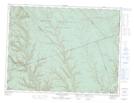
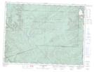
Maps showing Rivière Bonaventure, Bonaventure; Bonaventure, Quebec

Rivière Bonaventure is a River located in Bonaventure; Bonaventure, Quebec and has an elevation of 125 meters.

  • Latitude: 48° 2' 52'' North   (decimal: 48.0478272)
  • Longitude: 65° 27' 31'' West   (decimal: -65.4585262)
  • Topography Feature Category: River
  • Geographical Feature: Rivière
  • Canadian Province/Territory: Quebec
  • Elevation: 125 meters
  • Location: Bonaventure; Bonaventure
  • Atlas of Canada Locator Map: Rivière Bonaventure
  • GPS Coordinate Locator Map: Rivière Bonaventure Lat/Long

Rivière Bonaventure NTS Map Sheets

022A03 New Carlisle Topographic Map at 1:50,000 scale

022A04 New Richmond Topographic Map at 1:50,000 scale

022A05 Lac Mckay Topographic Map at 1:50,000 scale

022A06 Riviere Reboul Topographic Map at 1:50,000 scale

022A11 Mont Alexandre Topographic Map at 1:50,000 scale

022A12 Ruisseau Lesseps Topographic Map at 1:50,000 scale

022A13 Lac Madeleine Topographic Map at 1:50,000 scale

022A Gaspe Topographic Map at 1:250,000 scale

 
Buy Topographic Maps DVD
Newsletter Sign-up

Yes, I want to receive map store discounts.


Bookmark and Share