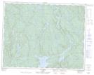
Maps showing Lac Boudreau, Lac-Jérôme; Minganie, Quebec
Lac Boudreau is a Lake located in Lac-Jérôme; Minganie, Quebec and has an elevation of 397 meters.
- Latitude: 50° 39' 51'' North (decimal: 50.6641667)
- Longitude: 65° 13' 57'' West (decimal: -65.2325)
- Topography Feature Category: Lake
- Geographical Feature: Lac
- Canadian Province/Territory: Quebec
- Elevation: 397 meters
- Location: Lac-Jérôme; Minganie
- Atlas of Canada Locator Map: Lac Boudreau
- GPS Coordinate Locator Map: Lac Boudreau Lat/Long
Lac Boudreau NTS Map Sheets