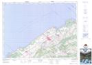
Maps showing Pointe aux Cenelles, Sainte-Flavie; La Mitis, Quebec
Pointe aux Cenelles is a Cape located in Sainte-Flavie; La Mitis, Quebec and has an elevation of 0 meters.
- Latitude: 48° 38' 27'' North (decimal: 48.6408743)
- Longitude: 68° 9' 0'' West (decimal: -68.1500152)
- Topography Feature Category: Cape
- Geographical Feature: Pointe
- Canadian Province/Territory: Quebec
- Elevation: 0 meters
- Location: Sainte-Flavie; La Mitis
- Atlas of Canada Locator Map: Pointe aux Cenelles
- GPS Coordinate Locator Map: Pointe aux Cenelles Lat/Long