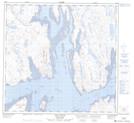
Maps showing Île en Cône, Rivière-Koksoak; Kativik, Quebec
Île en Cône is a Island located in Rivière-Koksoak; Kativik, Quebec and has an elevation of 5 meters.
- Latitude: 58° 46' 45'' North (decimal: 58.7790760)
- Longitude: 69° 47' 24'' West (decimal: -69.7901216)
- Topography Feature Category: Island
- Geographical Feature: Île / Ile
- Canadian Province/Territory: Quebec
- Elevation: 5 meters
- Location: Rivière-Koksoak; Kativik
- Atlas of Canada Locator Map: Île en Cône
- GPS Coordinate Locator Map: Île en Cône Lat/Long
Île en Cône NTS Map Sheets