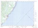
Maps showing Pointe à Crapaud, Les Bergeronnes; La Haute-Côte-Nord, Quebec
Pointe à Crapaud is a Cape located in Les Bergeronnes; La Haute-Côte-Nord, Quebec.
- Latitude: 48° 18' 26'' North (decimal: 48.3072452)
- Longitude: 69° 25' 13'' West (decimal: -69.4203284)
- Topography Feature Category: Cape
- Geographical Feature: Pointe
- Canadian Province/Territory: Quebec
- Location: Les Bergeronnes; La Haute-Côte-Nord
- GPS Coordinate Locator Map: Pointe à Crapaud Lat/Long
Pointe à Crapaud NTS Map Sheets