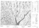
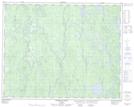
Maps showing Rivière à la Croix, Rivière-aux-Outardes; Manicouagan, Quebec
Rivière à la Croix is a River located in Rivière-aux-Outardes; Manicouagan, Quebec and has an elevation of 537 meters.
- Latitude: 51° 26' 10'' North (decimal: 51.4361111)
- Longitude: 69° 54' 25'' West (decimal: -69.9069444)
- Topography Feature Category: River
- Geographical Feature: Rivière
- Canadian Province/Territory: Quebec
- Elevation: 537 meters
- Location: Rivière-aux-Outardes; Manicouagan
- Atlas of Canada Locator Map: Rivière à la Croix
- GPS Coordinate Locator Map: Rivière à la Croix Lat/Long
Rivière à la Croix NTS Map Sheets