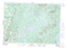
Maps showing Rivière Eaton, Westbury; Le Haut-Saint-François, Quebec
Rivière Eaton is a River located in Westbury; Le Haut-Saint-François, Quebec and has an elevation of 216 meters.
- Latitude: 45° 28' 19'' North (decimal: 45.4719852)
- Longitude: 71° 39' 6'' West (decimal: -71.6517564)
- Topography Feature Category: River
- Geographical Feature: Rivière
- Canadian Province/Territory: Quebec
- Elevation: 216 meters
- Location: Westbury; Le Haut-Saint-François
- Atlas of Canada Locator Map: Rivière Eaton
- GPS Coordinate Locator Map: Rivière Eaton Lat/Long
Rivière Eaton NTS Map Sheets