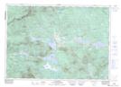
Maps showing Lac Émilie, Saint-Robert-Bellarmin; Le Granit, Quebec
Lac Émilie is a Lake located in Saint-Robert-Bellarmin; Le Granit, Quebec and has an elevation of 554 meters.
- Latitude: 45° 43' 41'' North (decimal: 45.7280961)
- Longitude: 70° 25' 18'' West (decimal: -70.4217340)
- Topography Feature Category: Lake
- Geographical Feature: Lac
- Canadian Province/Territory: Quebec
- Elevation: 554 meters
- Location: Saint-Robert-Bellarmin; Le Granit
- Atlas of Canada Locator Map: Lac Émilie
- GPS Coordinate Locator Map: Lac Émilie Lat/Long
Lac Émilie NTS Map Sheets