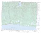
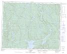
Maps showing Lac Fabien, Lac-Jérôme; Minganie, Quebec
Lac Fabien is a Lake located in Lac-Jérôme; Minganie, Quebec and has an elevation of 240 meters.
- Latitude: 50° 29' 35'' North (decimal: 50.4930556)
- Longitude: 65° 28' 42'' West (decimal: -65.4783333)
- Topography Feature Category: Lake
- Geographical Feature: Lac
- Canadian Province/Territory: Quebec
- Elevation: 240 meters
- Location: Lac-Jérôme; Minganie
- Atlas of Canada Locator Map: Lac Fabien
- GPS Coordinate Locator Map: Lac Fabien Lat/Long
Lac Fabien NTS Map Sheets