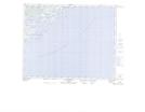
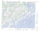
Maps showing Île Galibois, Saint-Augustin; Basse-Côte-Nord, Quebec
Île Galibois is a Island located in Saint-Augustin; Basse-Côte-Nord, Quebec and has an elevation of 0 meters.
- Latitude: 51° 11' 54'' North (decimal: 51.1983913)
- Longitude: 58° 30' 15'' West (decimal: -58.5041005)
- Topography Feature Category: Island
- Geographical Feature: Île / Ile
- Canadian Province/Territory: Quebec
- Elevation: 0 meters
- Location: Saint-Augustin; Basse-Côte-Nord
- Atlas of Canada Locator Map: Île Galibois
- GPS Coordinate Locator Map: Île Galibois Lat/Long
Île Galibois NTS Map Sheets