Canada Topographic Maps

Garneau Topo Maps

Topography maps and Latitude/Longitude Location

Maps showing Garneau, Sainte-Perpétue; L'Islet, Quebec

Garneau is a Geographical area located in Sainte-Perpétue; L'Islet, Quebec.

  • Latitude: 47° 1' North   (decimal: 47.0166666)
  • Longitude: 69° 59' West   (decimal: -69.9833333)
  • Topography Feature Category: Geographical area
  • Geographical Feature: Canton
  • Canadian Province/Territory: Quebec
  • Location: Sainte-Perpétue; L'Islet
  • Atlas of Canada Locator Map: Garneau
  • GPS Coordinate Locator Map: Garneau Lat/Long

Garneau NTS Map Sheets

021K13 Saint-Pamphile Topographic Map at 1:50,000 scale

021L16 Notre-Dame-Du-Rosaire Topographic Map at 1:50,000 scale

021M01 Saint-Jean-Port-Joli Topographic Map at 1:50,000 scale

021N04 Ste-Perpetue-De-Islet Topographic Map at 1:50,000 scale

021L Quebec Topographic Map at 1:250,000 scale

021M Baie-Saint-Paul Topographic Map at 1:250,000 scale

021N Edmundston Topographic Map at 1:250,000 scale

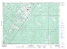
021K Map Not Available Topographic Map at 1:250,000 scale

 
Buy Topographic Maps DVD
Newsletter Sign-up

Yes, I want to receive map store discounts.


Bookmark and Share