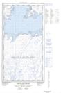
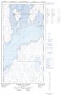
Maps showing Pointe Garry, Rivière-Koksoak; Kativik, Quebec
Pointe Garry is a Cape located in Rivière-Koksoak; Kativik, Quebec and has an elevation of 3 meters.
- Latitude: 58° 49' 10'' North (decimal: 58.8193451)
- Longitude: 69° 26' 27'' West (decimal: -69.4409482)
- Topography Feature Category: Cape
- Geographical Feature: Pointe
- Canadian Province/Territory: Quebec
- Elevation: 3 meters
- Location: Rivière-Koksoak; Kativik
- Atlas of Canada Locator Map: Pointe Garry
- GPS Coordinate Locator Map: Pointe Garry Lat/Long
Pointe Garry NTS Map Sheets