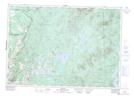
Maps showing Rivière Hall, East Hereford; Coaticook, Quebec
Rivière Hall is a River located in East Hereford; Coaticook, Quebec and has an elevation of 357 meters.
- Latitude: 45° 0' 30'' North (decimal: 45.0083788)
- Longitude: 71° 30' 16'' West (decimal: -71.5045259)
- Topography Feature Category: River
- Geographical Feature: Rivière
- Canadian Province/Territory: Quebec
- Elevation: 357 meters
- Location: East Hereford; Coaticook
- Atlas of Canada Locator Map: Rivière Hall
- GPS Coordinate Locator Map: Rivière Hall Lat/Long
Rivière Hall NTS Map Sheets