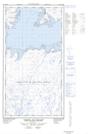
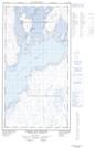
Maps showing Pointe Henderson, Rivière-Koksoak; Kativik, Quebec
Pointe Henderson is a Cape located in Rivière-Koksoak; Kativik, Quebec and has an elevation of 23 meters.
- Latitude: 58° 57' 14'' North (decimal: 58.9537864)
- Longitude: 69° 13' 40'' West (decimal: -69.2278809)
- Topography Feature Category: Cape
- Geographical Feature: Pointe
- Canadian Province/Territory: Quebec
- Elevation: 23 meters
- Location: Rivière-Koksoak; Kativik
- Atlas of Canada Locator Map: Pointe Henderson
- GPS Coordinate Locator Map: Pointe Henderson Lat/Long
Pointe Henderson NTS Map Sheets