Canada Topographic Maps

Ruisseau Highfall Topo Maps

Topography maps and Latitude/Longitude Location

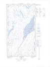
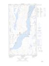
Maps showing Ruisseau Highfall, Rivière-Koksoak; Kativik, Quebec

Ruisseau Highfall is a River located in Rivière-Koksoak; Kativik, Quebec.

  • Latitude: 58° 1' 20'' North   (decimal: 58.0220973)
  • Longitude: 68° 29' 36'' West   (decimal: -68.4934199)
  • Topography Feature Category: River
  • Geographical Feature: Ruisseau
  • Canadian Province/Territory: Quebec
  • Location: Rivière-Koksoak; Kativik
  • Atlas of Canada Locator Map: Ruisseau Highfall
  • GPS Coordinate Locator Map: Ruisseau Highfall Lat/Long

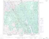
Ruisseau Highfall NTS Map Sheets

024F10E Lac Le Mercier Topographic Map at 1:50,000 scale

024F10W Lac Le Mercier Topographic Map at 1:50,000 scale

024F15 Lac Scattered Topographic Map at 1:50,000 scale

024F16 Lac Du Dome Topographic Map at 1:50,000 scale

024K01E Kuujjuaq Topographic Map at 1:50,000 scale

024K01W Kuujjuaq Topographic Map at 1:50,000 scale

024F Lac Herodier Topographic Map at 1:250,000 scale

024K Kuujjuaq Topographic Map at 1:250,000 scale

 
Buy Topographic Maps DVD
Newsletter Sign-up

Yes, I want to receive map store discounts.


Bookmark and Share