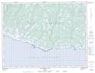
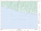
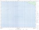
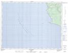
Maps showing Détroit d'Honguedo, Gaspé; La Côte-de-Gaspé, Quebec
Détroit d'Honguedo is a Channel located in Gaspé; La Côte-de-Gaspé, Quebec and has an elevation of 0 meters.
- Latitude: 49° 15' North (decimal: 49.2500000)
- Longitude: 64° 0' West (decimal: -64.0000000)
- Topography Feature Category: Channel
- Geographical Feature: Détroit
- Canadian Province/Territory: Quebec
- Elevation: 0 meters
- Location: Gaspé; La Côte-de-Gaspé
- Atlas of Canada Locator Map: Détroit d'Honguedo
- GPS Coordinate Locator Map: Détroit d'Honguedo Lat/Long
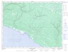
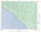
Détroit d'Honguedo NTS Map Sheets
012E01 Escarpement Bagot Topographic Map at 1:50,000 scale
012E02 Riviere Bilodeau Topographic Map at 1:50,000 scale
012E03 Riviere Chicotte Topographic Map at 1:50,000 scale
012E05 Anse Gibbons Topographic Map at 1:50,000 scale
012E06 Riviere Galiote Topographic Map at 1:50,000 scale
012E12 Riviere Au Fusil Topographic Map at 1:50,000 scale
022A16 Gaspe Topographic Map at 1:50,000 scale
022H01 Petit-Cap Topographic Map at 1:50,000 scale
022H02 Cloridorme Topographic Map at 1:50,000 scale
022H03 Grande-Vallee Topographic Map at 1:50,000 scale
022H09 Riviere Aux Becs-Scie Topographic Map at 1:50,000 scale
022H16 Port-Menier Topographic Map at 1:50,000 scale
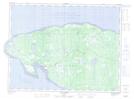
012E Ile D'Anticosti Topographic Map at 1:250,000 scale
022A Gaspe Topographic Map at 1:250,000 scale
022H Port-Menier Topographic Map at 1:250,000 scale