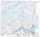
Maps showing Montagne Irraviluaq, Rivière-Koksoak; Kativik, Quebec
Montagne Irraviluaq is a Mountain located in Rivière-Koksoak; Kativik, Quebec.
- Latitude: 58° 48' 38'' North (decimal: 58.8104726)
- Longitude: 70° 6' 57'' West (decimal: -70.1159654)
- Topography Feature Category: Mountain
- Geographical Feature: Mont
- Canadian Province/Territory: Quebec
- Location: Rivière-Koksoak; Kativik
- Atlas of Canada Locator Map: Montagne Irraviluaq
- GPS Coordinate Locator Map: Montagne Irraviluaq Lat/Long
Montagne Irraviluaq NTS Map Sheets