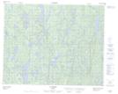
Maps showing Lac Kennedy, Petit-Mécatina; Minganie, Quebec
Lac Kennedy is a Lake located in Petit-Mécatina; Minganie, Quebec and has an elevation of 76 meters.
- Latitude: 51° 42' 14'' North (decimal: 51.7039470)
- Longitude: 58° 22' 45'' West (decimal: -58.3790841)
- Topography Feature Category: Lake
- Geographical Feature: Lac
- Canadian Province/Territory: Quebec
- Elevation: 76 meters
- Location: Petit-Mécatina; Minganie
- Atlas of Canada Locator Map: Lac Kennedy
- GPS Coordinate Locator Map: Lac Kennedy Lat/Long
Lac Kennedy NTS Map Sheets