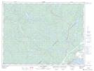
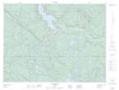
Maps showing Rivière Laval, Forestville; La Haute-Côte-Nord, Quebec
Rivière Laval is a River located in Forestville; La Haute-Côte-Nord, Quebec and has an elevation of 242 meters.
- Latitude: 48° 46' 24'' North (decimal: 48.7733643)
- Longitude: 69° 3' 2'' West (decimal: -69.0506046)
- Topography Feature Category: River
- Geographical Feature: Rivière
- Canadian Province/Territory: Quebec
- Elevation: 242 meters
- Location: Forestville; La Haute-Côte-Nord
- Atlas of Canada Locator Map: Rivière Laval
- GPS Coordinate Locator Map: Rivière Laval Lat/Long
Rivière Laval NTS Map Sheets