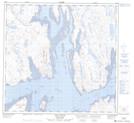
Maps showing Passage Leaf, Rivière-Koksoak; Kativik, Quebec
Passage Leaf is a Channel located in Rivière-Koksoak; Kativik, Quebec.
- Latitude: 58° 52' 0'' North (decimal: 58.8666667)
- Longitude: 69° 26' 18'' West (decimal: -69.4383333)
- Topography Feature Category: Channel
- Geographical Feature: Passe
- Canadian Province/Territory: Quebec
- Location: Rivière-Koksoak; Kativik
- GPS Coordinate Locator Map: Passage Leaf Lat/Long
Passage Leaf NTS Map Sheets