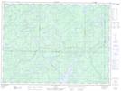
Maps showing Lac Leda, Senneterre; Vallée-de-l'Or, Quebec
Lac Leda is a Lake located in Senneterre; Vallée-de-l'Or, Quebec and has an elevation of 416 meters.
- Latitude: 47° 51' 2'' North (decimal: 47.8505556)
- Longitude: 75° 36' 7'' West (decimal: -75.6019444)
- Topography Feature Category: Lake
- Geographical Feature: Lac
- Canadian Province/Territory: Quebec
- Elevation: 416 meters
- Location: Senneterre; Vallée-de-l'Or
- Atlas of Canada Locator Map: Lac Leda
- GPS Coordinate Locator Map: Lac Leda Lat/Long
Lac Leda NTS Map Sheets