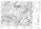
Maps showing Rivière Lerole, Mont-Valin; Le Fjord-du-Saguenay, Quebec
Rivière Lerole is a River located in Mont-Valin; Le Fjord-du-Saguenay, Quebec and has an elevation of 644 meters.
- Latitude: 51° 42' 28'' North (decimal: 51.7078622)
- Longitude: 70° 56' 2'' West (decimal: -70.9339553)
- Topography Feature Category: River
- Geographical Feature: Rivière
- Canadian Province/Territory: Quebec
- Elevation: 644 meters
- Location: Mont-Valin; Le Fjord-du-Saguenay
- Atlas of Canada Locator Map: Rivière Lerole
- GPS Coordinate Locator Map: Rivière Lerole Lat/Long
Rivière Lerole NTS Map Sheets