Canada Topographic Maps

Rivière Manitou Topo Maps

Topography maps and Latitude/Longitude Location

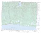
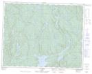
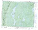
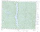
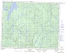
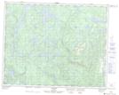
Maps showing Rivière Manitou, Rivière-au-Tonnerre; Minganie, Quebec

Rivière Manitou is a River located in Rivière-au-Tonnerre; Minganie, Quebec and has an elevation of 61 meters.

  • Latitude: 50° 17' 52'' North   (decimal: 50.2977778)
  • Longitude: 65° 14' 29'' West   (decimal: -65.2413889)
  • Topography Feature Category: River
  • Geographical Feature: Rivière
  • Canadian Province/Territory: Quebec
  • Elevation: 61 meters
  • Location: Rivière-au-Tonnerre; Minganie
  • Atlas of Canada Locator Map: Rivière Manitou
  • GPS Coordinate Locator Map: Rivière Manitou Lat/Long

Rivière Manitou NTS Map Sheets

022I06 Riviere Aux Graines Topographic Map at 1:50,000 scale

022I08 Mingan Topographic Map at 1:50,000 scale

022I11 Lac Brezel Topographic Map at 1:50,000 scale

022I13 Lac Nipisso Topographic Map at 1:50,000 scale

022I14 Lac Manitou Topographic Map at 1:50,000 scale

022P03 Lac A L'Aigle Topographic Map at 1:50,000 scale

022P06 Lac Vital Topographic Map at 1:50,000 scale

022I Lac Manitou Topographic Map at 1:250,000 scale

022P Lac Fournier Topographic Map at 1:250,000 scale

 
Buy Topographic Maps DVD
Newsletter Sign-up

Yes, I want to receive map store discounts.


Bookmark and Share