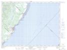
Maps showing Lac Michaud, Les Escoumins; La Haute-Côte-Nord, Quebec
Lac Michaud is a Lake located in Les Escoumins; La Haute-Côte-Nord, Quebec.
- Latitude: 48° 27' 36'' North (decimal: 48.4600252)
- Longitude: 69° 28' 50'' West (decimal: -69.4806103)
- Topography Feature Category: Lake
- Geographical Feature: Lac
- Canadian Province/Territory: Quebec
- Location: Les Escoumins; La Haute-Côte-Nord
- GPS Coordinate Locator Map: Lac Michaud Lat/Long
Lac Michaud NTS Map Sheets