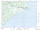
Maps showing Pointe à Michel, Colombier; La Haute-Côte-Nord, Quebec
Pointe à Michel is a Cape located in Colombier; La Haute-Côte-Nord, Quebec and has an elevation of 0 meters.
- Latitude: 48° 55' 11'' North (decimal: 48.9197626)
- Longitude: 68° 37' 9'' West (decimal: -68.6192075)
- Topography Feature Category: Cape
- Geographical Feature: Pointe
- Canadian Province/Territory: Quebec
- Elevation: 0 meters
- Location: Colombier; La Haute-Côte-Nord
- Atlas of Canada Locator Map: Pointe à Michel
- GPS Coordinate Locator Map: Pointe à Michel Lat/Long
Pointe à Michel NTS Map Sheets