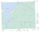
Maps showing Île Middleton, Waskaganish; Jamésie, Quebec
Île Middleton is a Island located in Waskaganish; Jamésie, Quebec and has an elevation of 0 meters.
- Latitude: 51° 22' 39'' North (decimal: 51.3775)
- Longitude: 78° 52' 49'' West (decimal: -78.8802778)
- Topography Feature Category: Island
- Geographical Feature: Île / Ile
- Canadian Province/Territory: Quebec
- Elevation: 0 meters
- Location: Waskaganish; Jamésie
- Atlas of Canada Locator Map: Île Middleton
- GPS Coordinate Locator Map: Île Middleton Lat/Long
Île Middleton NTS Map Sheets