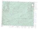
Maps showing Ruisseau Miller, Collines-du-Basque; La Côte-de-Gaspé, Quebec
Ruisseau Miller is a River located in Collines-du-Basque; La Côte-de-Gaspé, Quebec and has an elevation of 507 meters.
- Latitude: 48° 54' 30'' North (decimal: 48.9083821)
- Longitude: 65° 25' 38'' West (decimal: -65.4271404)
- Topography Feature Category: River
- Geographical Feature: Ruisseau
- Canadian Province/Territory: Quebec
- Elevation: 507 meters
- Location: Collines-du-Basque; La Côte-de-Gaspé
- Atlas of Canada Locator Map: Ruisseau Miller
- GPS Coordinate Locator Map: Ruisseau Miller Lat/Long
Ruisseau Miller NTS Map Sheets