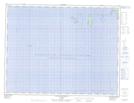
Maps showing Banc de Mingan, Longue-Pointe-de-Mingan; Minganie, Quebec
Banc de Mingan is a Shoal located in Longue-Pointe-de-Mingan; Minganie, Quebec.
- Latitude: 50° 9' 30'' North (decimal: 50.1584022)
- Longitude: 64° 7' 28'' West (decimal: -64.1243332)
- Topography Feature Category: Shoal
- Geographical Feature: Bancs
- Canadian Province/Territory: Quebec
- Location: Longue-Pointe-de-Mingan; Minganie
- GPS Coordinate Locator Map: Banc de Mingan Lat/Long
Banc de Mingan NTS Map Sheets