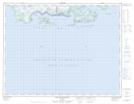
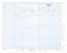
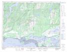
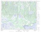
Maps showing Īles de Mingan, Havre-Saint-Pierre; Minganie, Quebec
Īles de Mingan is a Island located in Havre-Saint-Pierre; Minganie, Quebec and has an elevation of 0 meters.
- Latitude: 50° 13' 35'' North (decimal: 50.2263889)
- Longitude: 63° 37' 30'' West (decimal: -63.6250000)
- Topography Feature Category: Island
- Geographical Feature: Īles / Iles
- Canadian Province/Territory: Quebec
- Elevation: 0 meters
- Location: Havre-Saint-Pierre; Minganie
- Atlas of Canada Locator Map: Īles de Mingan
- GPS Coordinate Locator Map: Īles de Mingan Lat/Long
Īles de Mingan NTS Map Sheets
012L03 Baie Des Trilobites Topographic Map at 1:50,000 scale
012L04 Havre-St-Pierre Topographic Map at 1:50,000 scale
012L05 Lac Du Gros Diable Topographic Map at 1:50,000 scale
012L06 Lac A L'Ours Topographic Map at 1:50,000 scale
022I01 Ile Nue De Mingan Topographic Map at 1:50,000 scale
012L Havre-Saint-Pierre Topographic Map at 1:250,000 scale
022I Lac Manitou Topographic Map at 1:250,000 scale