Canada Topographic Maps

Rivière Mingan Topo Maps

Topography maps and Latitude/Longitude Location

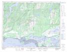
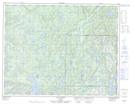
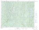
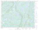
Maps showing Rivière Mingan, Havre-Saint-Pierre; Minganie, Quebec

Rivière Mingan is a River located in Havre-Saint-Pierre; Minganie, Quebec and has an elevation of 111 meters.

  • Latitude: 50° 17' 45'' North   (decimal: 50.2958333)
  • Longitude: 63° 59' 22'' West   (decimal: -63.9894444)
  • Topography Feature Category: River
  • Geographical Feature: Rivière
  • Canadian Province/Territory: Quebec
  • Elevation: 111 meters
  • Location: Havre-Saint-Pierre; Minganie
  • Atlas of Canada Locator Map: Rivière Mingan
  • GPS Coordinate Locator Map: Rivière Mingan Lat/Long

Rivière Mingan NTS Map Sheets

012L05 Lac Du Gros Diable Topographic Map at 1:50,000 scale

012L12 Lac Cugnet Topographic Map at 1:50,000 scale

012L13 Lac Jerome Topographic Map at 1:50,000 scale

012L14 Lac Sanson Topographic Map at 1:50,000 scale

022I08 Mingan Topographic Map at 1:50,000 scale

012L Havre-Saint-Pierre Topographic Map at 1:250,000 scale

022I Lac Manitou Topographic Map at 1:250,000 scale

 
Buy Topographic Maps DVD
Newsletter Sign-up

Yes, I want to receive map store discounts.


Bookmark and Share