Canada Topographic Maps

Rivière Missisicabi Topo Maps

Topography maps and Latitude/Longitude Location

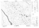
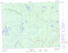
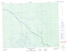
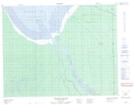
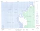
Maps showing Rivière Missisicabi, Baie-James; Jamésie, Quebec

Rivière Missisicabi is a River located in Baie-James; Jamésie, Quebec and has an elevation of 3 meters.

  • Latitude: 51° 13' 27'' North   (decimal: 51.2241667)
  • Longitude: 79° 31' 5'' West   (decimal: -79.5180555)
  • Topography Feature Category: River
  • Geographical Feature: Rivière
  • Canadian Province/Territory: Quebec
  • Elevation: 3 meters
  • Location: Baie-James; Jamésie
  • Atlas of Canada Locator Map: Rivière Missisicabi
  • GPS Coordinate Locator Map: Rivière Missisicabi Lat/Long

Rivière Missisicabi NTS Map Sheets

032L14 Lac Salomon Topographic Map at 1:50,000 scale

032L15 Riviere Patrick Topographic Map at 1:50,000 scale

032M03 Riviere Iscouistic Topographic Map at 1:50,000 scale

032M04 Francis Island Topographic Map at 1:50,000 scale

032M05 Petite Riviere Missisicabi Topographic Map at 1:50,000 scale

032L Riviere Harricana Topographic Map at 1:250,000 scale

032M Fort-Rupert Topographic Map at 1:250,000 scale

 
Buy Topographic Maps DVD
Newsletter Sign-up

Yes, I want to receive map store discounts.


Bookmark and Share