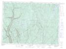
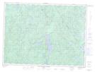
Maps showing Rivière Montmorency, Boischatel; La Côte-de-Beaupré, Quebec
Rivière Montmorency is a River located in Boischatel; La Côte-de-Beaupré, Quebec and has an elevation of 49 meters.
- Latitude: 46° 53' 6'' North (decimal: 46.8850225)
- Longitude: 71° 8' 34'' West (decimal: -71.1428619)
- Topography Feature Category: River
- Geographical Feature: Rivière
- Canadian Province/Territory: Quebec
- Elevation: 49 meters
- Location: Boischatel; La Côte-de-Beaupré
- Atlas of Canada Locator Map: Rivière Montmorency
- GPS Coordinate Locator Map: Rivière Montmorency Lat/Long
Rivière Montmorency NTS Map Sheets