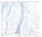
Maps showing The Narrows, Rivière-Koksoak; Kativik, Quebec
The Narrows is a Channel located in Rivière-Koksoak; Kativik, Quebec and has an elevation of 1 meters.
- Latitude: 58° 27' 9'' North (decimal: 58.4525)
- Longitude: 68° 10' 51'' West (decimal: -68.1808333)
- Topography Feature Category: Channel
- Geographical Feature: Passe
- Canadian Province/Territory: Quebec
- Elevation: 1 meters
- Location: Rivière-Koksoak; Kativik
- Atlas of Canada Locator Map: The Narrows
- GPS Coordinate Locator Map: The Narrows Lat/Long
The Narrows NTS Map Sheets