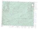
Maps showing Mont Needle, Murdochville; La Côte-de-Gaspé, Quebec
Mont Needle is a Mountain located in Murdochville; La Côte-de-Gaspé, Quebec.
- Latitude: 48° 56' 48'' North (decimal: 48.9467145)
- Longitude: 65° 31' 1'' West (decimal: -65.5168675)
- Topography Feature Category: Mountain
- Geographical Feature: Mont
- Canadian Province/Territory: Quebec
- Location: Murdochville; La Côte-de-Gaspé
- GPS Coordinate Locator Map: Mont Needle Lat/Long
Mont Needle NTS Map Sheets