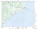
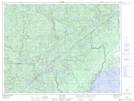
Maps showing Rivière Nipi, Betsiamites; Manicouagan, Quebec
Rivière Nipi is a River located in Betsiamites; Manicouagan, Quebec and has an elevation of 111 meters.
- Latitude: 48° 56' 34'' North (decimal: 48.9428164)
- Longitude: 68° 45' 47'' West (decimal: -68.7631002)
- Topography Feature Category: River
- Geographical Feature: Rivière
- Canadian Province/Territory: Quebec
- Elevation: 111 meters
- Location: Betsiamites; Manicouagan
- Atlas of Canada Locator Map: Rivière Nipi
- GPS Coordinate Locator Map: Rivière Nipi Lat/Long
Rivière Nipi NTS Map Sheets