Canada Topographic Maps

Rivière North Branch Topo Maps

Topography maps and Latitude/Longitude Location

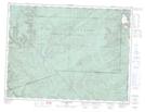
Maps showing Rivière North Branch, Gaspé; La Côte-de-Gaspé, Quebec

Rivière North Branch is a River located in Gaspé; La Côte-de-Gaspé, Quebec.

  • Latitude: 48° 46' 8'' North   (decimal: 48.7689461)
  • Longitude: 64° 26' 49'' West   (decimal: -64.4468207)
  • Topography Feature Category: River
  • Geographical Feature: Rivière
  • Canadian Province/Territory: Quebec
  • Location: Gaspé; La Côte-de-Gaspé
  • GPS Coordinate Locator Map: Rivière North Branch Lat/Long

Rivière North Branch NTS Map Sheets

022A10 Grande Riviere Nord Topographic Map at 1:50,000 scale

022A11 Mont Alexandre Topographic Map at 1:50,000 scale

022A13 Lac Madeleine Topographic Map at 1:50,000 scale

022A14 Lac York Topographic Map at 1:50,000 scale

022A15 Sunny-Bank Topographic Map at 1:50,000 scale

022A16 Gaspe Topographic Map at 1:50,000 scale

022A Gaspe Topographic Map at 1:250,000 scale

 
Buy Topographic Maps DVD
Newsletter Sign-up

Yes, I want to receive map store discounts.


Bookmark and Share