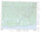
Maps showing Pointe Ore, Rivière-au-Tonnerre; Minganie, Quebec
Pointe Ore is a Cape located in Rivière-au-Tonnerre; Minganie, Quebec.
- Latitude: 50° 15' 51'' North (decimal: 50.2641667)
- Longitude: 64° 57' 34'' West (decimal: -64.9594444)
- Topography Feature Category: Cape
- Geographical Feature: Pointe
- Canadian Province/Territory: Quebec
- Location: Rivière-au-Tonnerre; Minganie
- GPS Coordinate Locator Map: Pointe Ore Lat/Long
Pointe Ore NTS Map Sheets