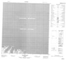
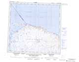
Maps showing Cap Pachot, Baie-d'Hudson; Kativik, Quebec
Cap Pachot is a Cape located in Baie-d'Hudson; Kativik, Quebec.
- Latitude: 62° 30' 53'' North (decimal: 62.5147684)
- Longitude: 76° 45' 58'' West (decimal: -76.7662164)
- Topography Feature Category: Cape
- Geographical Feature: Cap
- Canadian Province/Territory: Quebec
- Location: Baie-d'Hudson; Kativik
- Atlas of Canada Locator Map: Cap Pachot
- GPS Coordinate Locator Map: Cap Pachot Lat/Long
Cap Pachot NTS Map Sheets