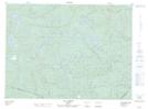
Maps showing Rivière aux Perches, Lac-au-Brochet; La Haute-Côte-Nord, Quebec
Rivière aux Perches is a River located in Lac-au-Brochet; La Haute-Côte-Nord, Quebec.
- Latitude: 48° 43' 50'' North (decimal: 48.7305849)
- Longitude: 69° 35' 18'' West (decimal: -69.5883910)
- Topography Feature Category: River
- Geographical Feature: Rivière
- Canadian Province/Territory: Quebec
- Location: Lac-au-Brochet; La Haute-Côte-Nord
- Atlas of Canada Locator Map: Rivière aux Perches
- GPS Coordinate Locator Map: Rivière aux Perches Lat/Long
Rivière aux Perches NTS Map Sheets