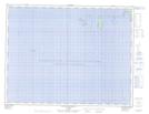
Maps showing Îles aux Perroquets, Longue-Pointe-de-Mingan; Minganie, Quebec
Îles aux Perroquets is a Island located in Longue-Pointe-de-Mingan; Minganie, Quebec and has an elevation of 0 meters.
- Latitude: 50° 12' 49'' North (decimal: 50.2136807)
- Longitude: 64° 12' 5'' West (decimal: -64.2012804)
- Topography Feature Category: Island
- Geographical Feature: Îles / Iles
- Canadian Province/Territory: Quebec
- Elevation: 0 meters
- Location: Longue-Pointe-de-Mingan; Minganie
- Atlas of Canada Locator Map: Îles aux Perroquets
- GPS Coordinate Locator Map: Îles aux Perroquets Lat/Long
Îles aux Perroquets NTS Map Sheets