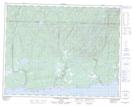
Maps showing Lac Queue de Chat, Lac-Jérôme; Minganie, Quebec
Lac Queue de Chat is a Lake located in Lac-Jérôme; Minganie, Quebec and has an elevation of 137 meters.
- Latitude: 50° 24' 37'' North (decimal: 50.4102778)
- Longitude: 64° 37' 55'' West (decimal: -64.6319444)
- Topography Feature Category: Lake
- Geographical Feature: Lac
- Canadian Province/Territory: Quebec
- Elevation: 137 meters
- Location: Lac-Jérôme; Minganie
- Atlas of Canada Locator Map: Lac Queue de Chat
- GPS Coordinate Locator Map: Lac Queue de Chat Lat/Long
Lac Queue de Chat NTS Map Sheets